I wrote this blog post a while ago after a trip to Australia in 2016 but found it recently and thought it might be inspirational for those looking at solutions that can solve drought and flood risk issues.
Why take a WSUD Walking tour?
Every holiday needs a good walking tour, especially in a city such as Melbourne. Even better is a water themed walking tour and the City of Melbourne have several self guided tours on their website related to Water Sensitive Urban Design (WSUD).
WSUD gained in prominence as a term in Australia from the 1990s and can broadly be defined as “an approach to the planning and design of urban environments that supports healthy ecosystems, lifestyles and livelihoods through smart management of all our waters”. The WSUD scoping study for the UK presents this as the pieces of the puzzle coming together and in-practice getting first conversations started around integration is key. Linked to this is the need for evidence to support WSUD approaches and demonstrators
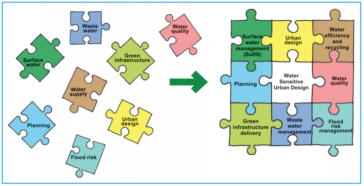
Figure 1: WSUD as a holistic approach (CIRIA, 2013)
Staying in the inner suburb of Richmond provided the perfect starting point for 2.2km long East Melbourne Walking Tour. In this blog I provide thoughts on the WSUD examples in Melbourne and implications for the UK. In the UK WSUD is often talked about primarily in the context of reducing surface flooding risk, however the stops on this walking tour mainly focussed on reducing potable water use/ resilience, water quality improvement and groundwater issues.
Stops on the way
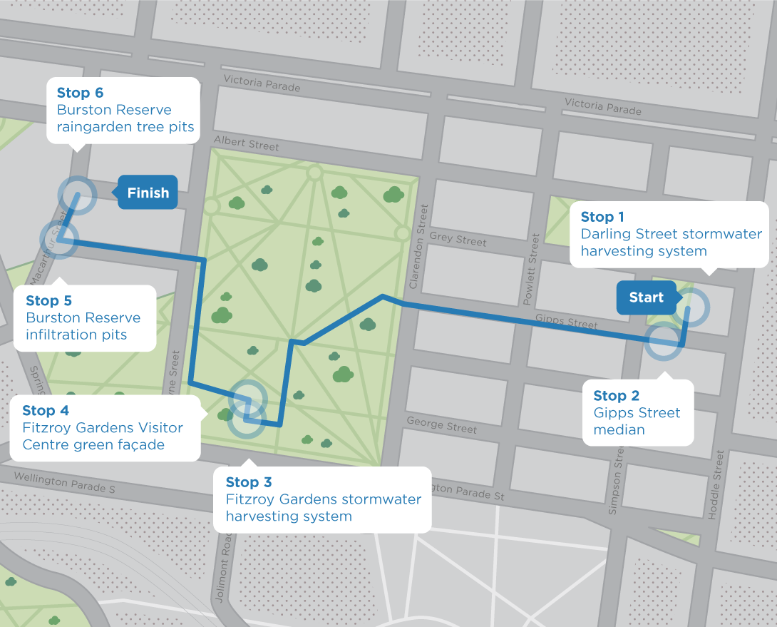
Figure 2: East Melbourne WSUD Walking Tour
Stop 1: Stormwater harvesting at Darling Street
The stormwater harvesting system beneath Darling Street provides treated stormwater to irrigate neighbouring parks and median strips. This was the first stormwater harvesting system constructed in the City of Melbourne and is well integrated into the streetscape. The bioretention systems at street level provide biological treatment in addition to the pollutant traps, sedimentation chambers, and UV treatment belowground. The project made use of the opportunity of an existing local streetscape upgrade to trial a new approach.
In context, watering restrictions during the Millennium Drought resulted in many tree deaths and impacts on usefulness of parks and recreation spaces. It is estimated that 23% of the city's tree population will be lost by 2020. This example demonstrates use of WSUD for reducing water use and protecting the wider benefits of parks and recreational spaces as well as managing stormwater.
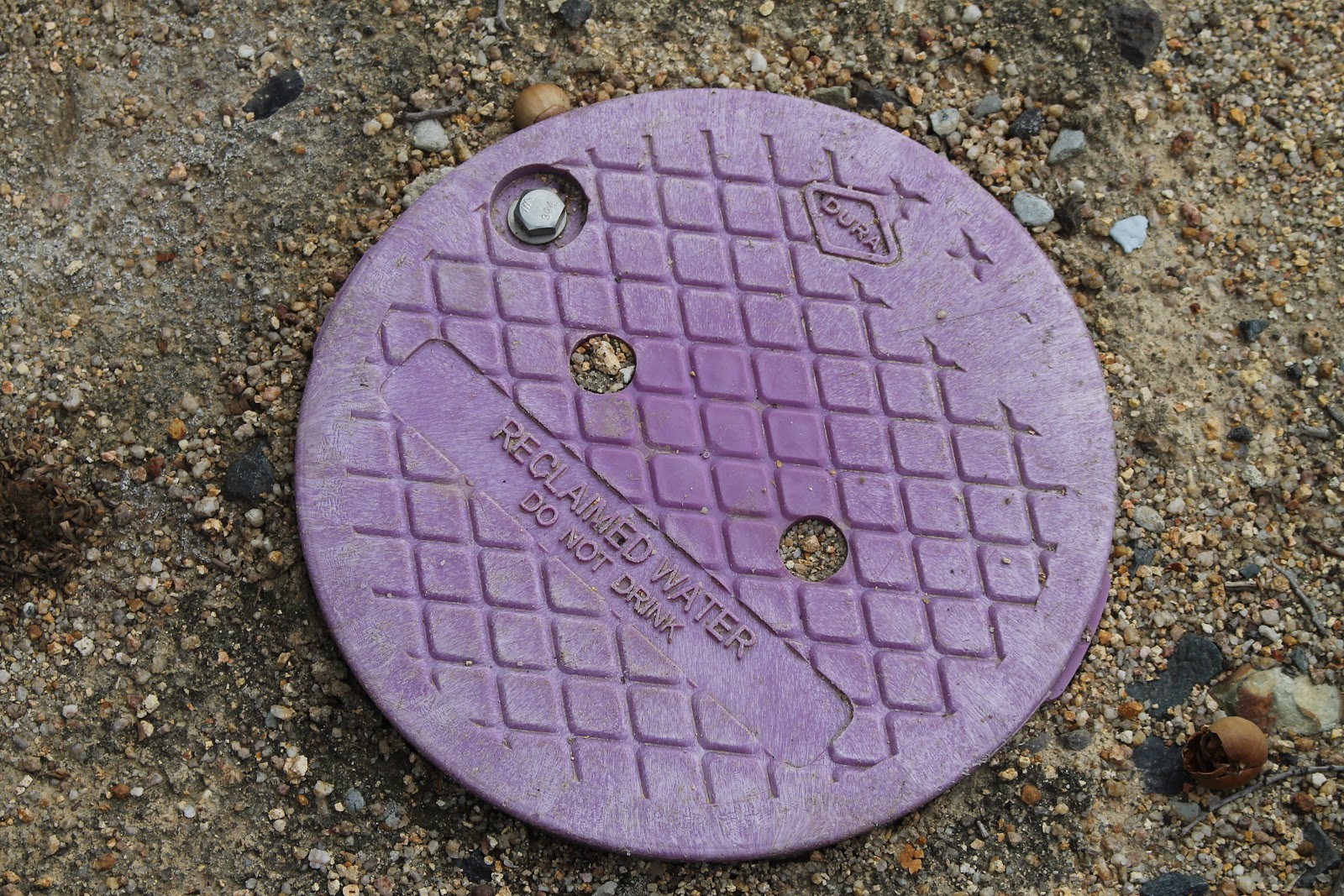
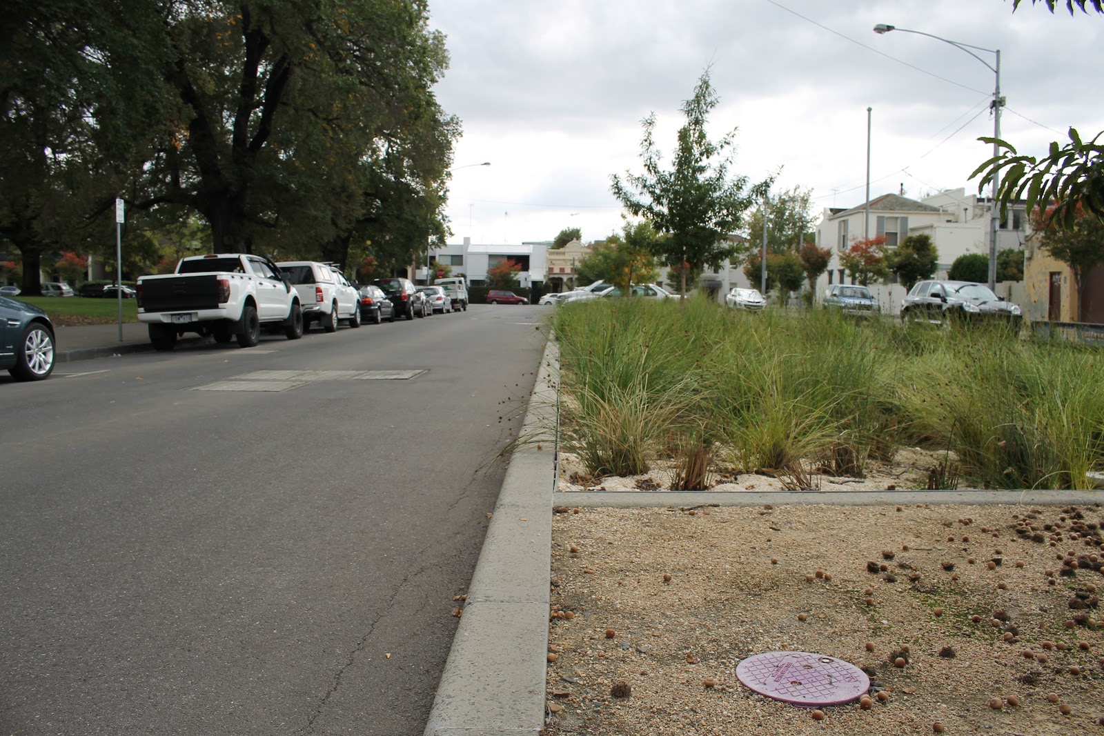
Figure 3: Recycled Water and biofilter bed at Darling Street
Stop 2: Gipps Street median
This project was focussed on reducing issues from a high watertable and waterlogged soils. To address these issues a median strip was developed with train that are passively watered by excess water from the root system of footpath trees.
With a focus on groundwater management this stop demonstrates that WSUD is not just about surface water management and flooding issues.
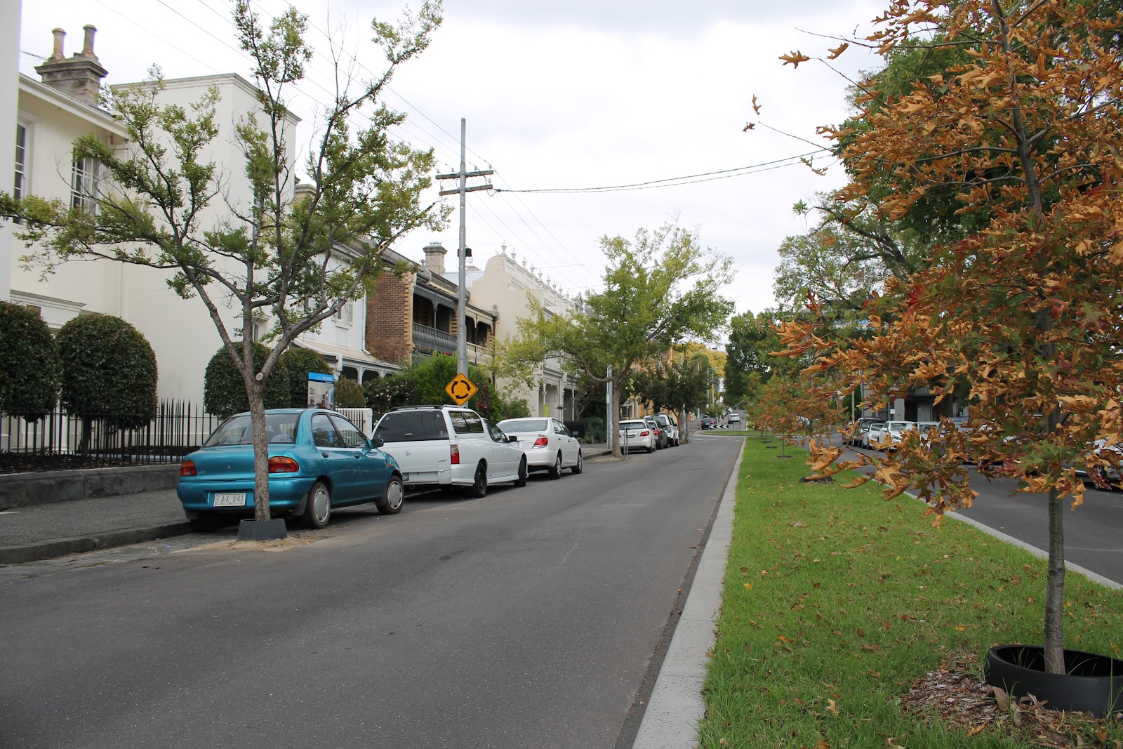
Figure 4: Excess water from the street trees by the curb drains into the central median strip to reduce waterlogging
Although the system isn’t very visible in some ways it was interesting to see a local home that has also embraced use of rainwater and reclaimed water for their garden.
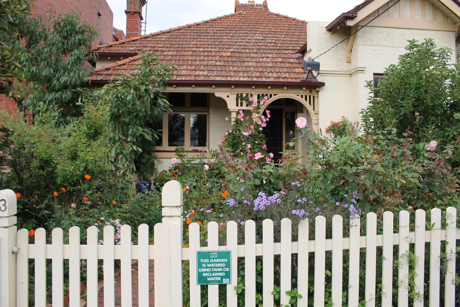
Figure 5: Local gardeners also using recycled water
Stop 3: Fitzroy Gardens Visitor Centre
Fitzroy Gardens is home to Captain Cook’s house (imported from the UK) and to a much larger stormwater harvesting system. The surrounding 67-hectare catchment drains to this natural low point and stormwater has now been diverted here for treatment. This system follows a similar treatment train to Stop 2: pollutant traps and sedimentation; primary holding tank; biofiltration beds; reuse tank; then finally, UV treatment before use in irrigation.
Approaching the site on the walking tour the scheme isn’t particularly visible, however you can distinguish the area where the underground tanks are sited. The signage for the scheme is quite visible by the visitors centre and there are park benches by the bioretention beds that integrate an amenity element. The scheme saves approximately 70 million litres of drinking water per year from being used for irrigation, provides reliable irrigation water for the heritage gardens and reduces pollutant loads from entering the Yarra River and Port Phillip Bay.
Water recycling and decentralised water solutions can cause concerns around carbon emissions. For this scheme the initial intention was to install renewable energy systems to cover consumption energy use from pumping, however a change in council policy lead to an energy audit and offsetting approach as part of a wider Carbon Neutrality approach for the city.

Figure 6: Biofiltration beds at Fitzroy gardens

Figure 7: Educational signage at Fitzroy Garden
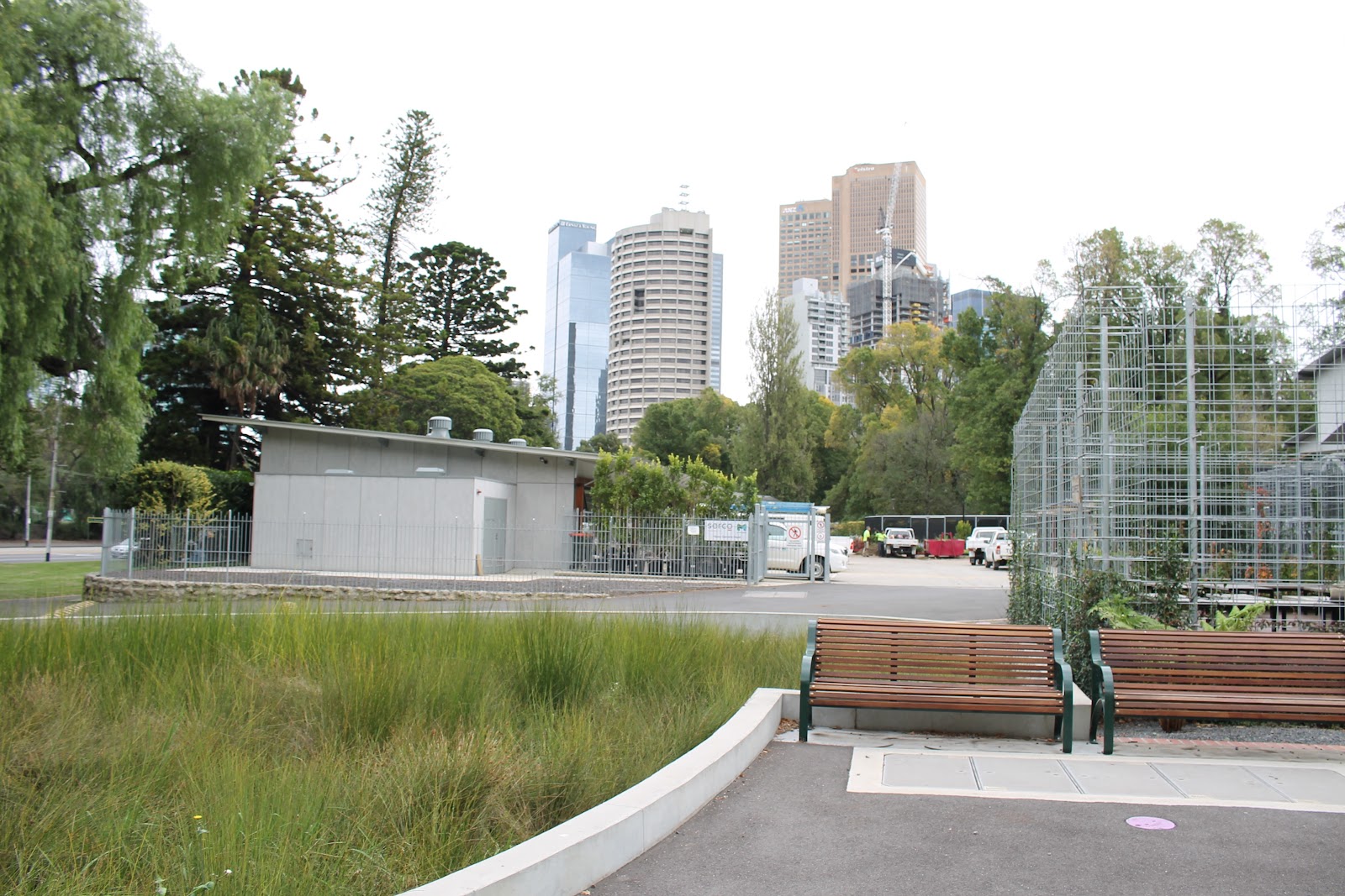
Figure 8: Biofiltration bed with City of Melbourne CBD in background
Stop 4: Green facade at the Fitzroy Gardens Visitor Centre
A green facade was installed to help the new visitors centre blend into the surroundings. This was combined with sprays by the windows to both shade the building and reduce the temperature of air drawn in through windows and doors.
On the date of our visit it looked like the facade had grown compared with installation photos, however it hasn’t covered the full area yet and it is questionable how much cooling is being provided.
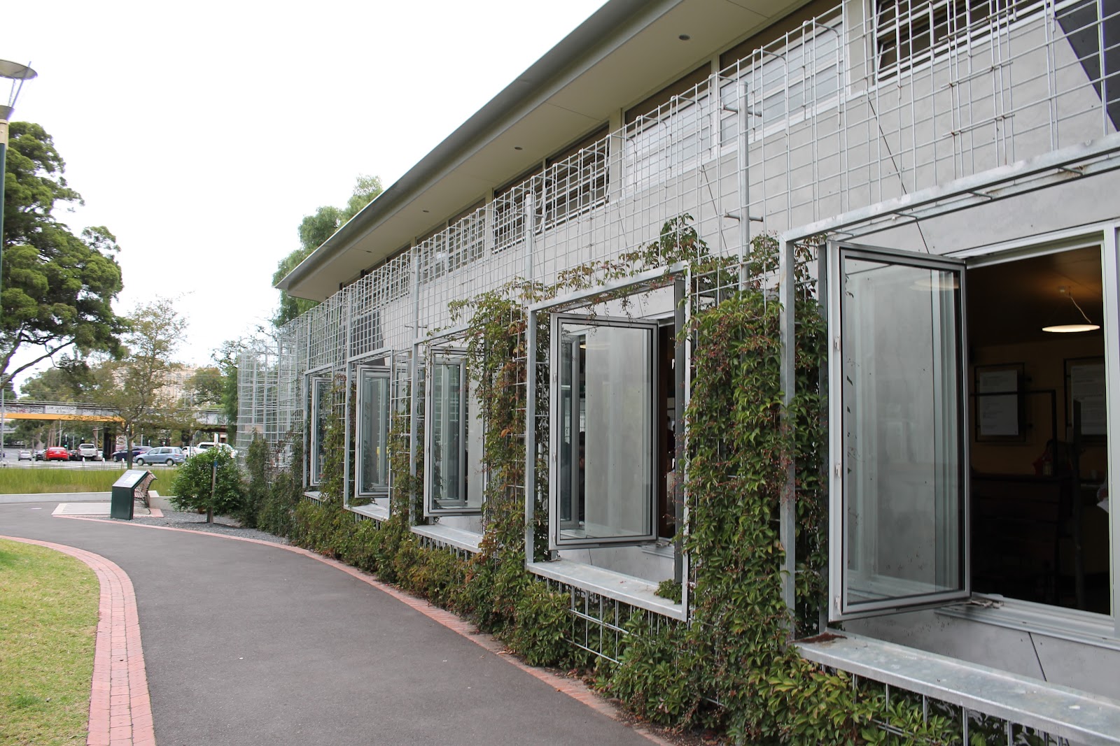
Figure 9: Green facade at Fitzroy garden visitors centre
Stop 5 & 6: Burston Reserve infiltration pits and raingarden tree pits
For the last two stops it was harder to distinguish the tree infiltration pits and there was no signage. The raingarden on Macarthur street is visible and along with the tree pits functions to improve water quality by filtering nitrogen, phosphorus and oils.

Figure 10: Tree infiltration pits

Figure 11: Raingarden
WSUD walks and opportunities for other cities
The walking tour was a great way to see Melbourne and to learn more about the WSUD case studies. Being able to access this via a PDF and the website provided flexibility for overseas visitors to be able to access the information on a smartphone (i.e. you don't need access to mobile data).
Other cities can definitely learn from this. Having recently travelled to Malmo, Sweden (something for another blog post) - it is much harder to find information from reports and presentation whilst exploring an area. In Portland there were good maps but we ran out of time to follow in detail any of the walking tours (link to GI tours).
Demonstrator projects are now being seen as an important step in policy transitions towards more integrated water management in the UK. In addition to site visits with professional bodies it would definitely help to have similar self-guided walking tours made available. For example, a recent walking tour of green infrastructure in London could have been written up for other to follow and share the learning. There is a map of SuDS in London available from GLA, however these sites could be linked together to create an informative walking tour. Perhaps this is something that Susdrain can pick up with partners in the UK from a SuDS perspective.


No comments:
Post a Comment